Thursday 13 December 2012

original penta-system in Google Earth

In earlier posts I covered the geometry I had found in detail with full calculations prior to having Google Earth to play with, using full Ordnance Survey coordinates which I think left some totally confused.

In this post I now want to cover the original pentagonal system I found back in 1995 and to see what connections turn up with the other systems I have discussed, the Mavisbank hexagonal, for instance and perhaps also the grid of the city of Edinburgh which I discovered lately.  Well there is quite a lot and it will take some time to cover what I have found already.

The pentagonal system I found came after months of drawing lines on maps quite a few of which ended up a right mess till I was finally convinced that what I had found was in fact real.  A final version was established when the Eagle's Nest spot was discovered linking at least three separate systems, the pentagonal, the Borthwick system and a direct link to the Preston unicorn Cross, with an accuracy somewhat beyond belief, all described previously in this blog.

I have done this present exercise without reference back to the relevant posts and this first pass throws up some of the queries I struggled with before, but I chose to work this way as some interesting stuff has come up which I want to explore further.

One advantage of using Google Earth is that true north can be established from any given point whereas the Ordnance Survey grid has only its own specific orientation and a rough guide to magnetic north.  True bearings thus difficult to establish!  I shall be investigating this aspect later, some intriguing stuff already showing up.

This first image shows the penta-system in conjunction with the hex-system previously covered.  At this stage I have drawn in a double pentagon, which allows for the slack in the system which I struggled with originally and is still possibly pertinent.  The line to the left running from bottom slightly west of north to the top, (pale blue then continues pale yellow), was in fact one of the most impressive early lines to be found.  Braidwood is a ringed earthwork just west of Penicuik, and the line includes the summits of both Scald Law and Black Hill, through Currie Kirk, and a hillock with a walled circle of trees on its top in a field at Cammo.  It was when I took a right-angle from Currie Kirk that Galachlaw was found and the confluence of the two Esk rivers at Dalkeith mentioned in my recent post(First Geometry) which defined the altitude of the original pentagon.  The Braidwood - Curriekirk - Cammo line extends both north and south and shall be discussed later.

In addition, it can be seen that the exact line from Mavisbank through the galachlaw point through the intersection of the initial circle to a 'flower of life' format intersects this Braidwood line at Cammo!

The initial Mavisbank circle in yellow can be seen to pass through the marker circles of both Galachlaw, the centre of the pentagon and Shewington, a farm house on a ridge to the south of Mavisbank.  The line from Shewington connects with Rosslyn Chapel then through Galachlaw to the highest point at the east end of the island of Inchcolm.

Newbattle Abbey is also on this circle circumference and shall be considered in the next post  which shows even more astonishing stuff than all that has been covered previously.  (As does the Leith corner in next paragraph.) More new revelations!  (TG-15/1/13.)

The chord from the Leith corner, top-most (unmarked in this image) through the exact summit of Arthurs Seat through Shewington is the orientation which hits the Eagles Nest point exactly.

click on image for full-screen version!

This second image has the secondary hex-circles stripped away and some of the points mentioned above marked.  The first point to note is that Rosslyn Chapel can be seen to lie on the line joining the mip-points of two of the pentagon sides and this line extends to/from Braidwood.  Rosslyn could be defining an inner system which almost includes the earthwork at Mavisbank.  This shall be examined later!  I have left the yellow line from Mavisbank to the Scott Monument in as The Scott Monument can be seen to be on the penta-chord from Black Hill to Leith.  I have also noticed and confirmed that The Scott Monument is at the midpoint of the upper section of the chord.  Again to be looked at later!

The penta-side from Gyle to Leith crosses Corstorphine Hill , the two lines shown straddling Clermiston Tower, dedicated to Sir Walter Scott!  Also, I have included one of the Edinburgh grid lines(orange) which extends to the Gyle/Gogar penta-corner!  Also the chord from Shewington to Gyle/Gogar includes Caerketton Hill, and the radius from Galachlaw to Black Hill includes Allermuir, both seen as green mountain symbols!


This image is a close-up of the Galachlaw, Shewington, Mavisbank, Rosslyn Chapel configuration!


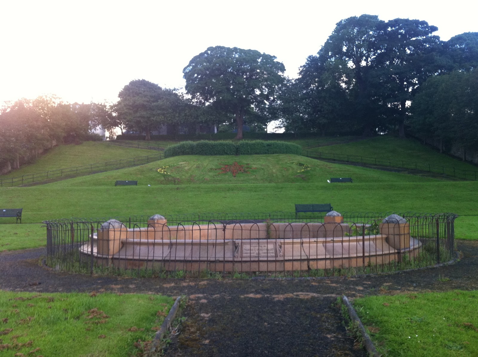
Galachlaw cairn, roughly as it is impossible to see it through the trees but I can get the exact coordinates later!  The Mavisbank circle (yellow) can be seen to fall a little short, but its close enough for now! Incidentally, the wooded area is somewhat reminiscent of an elephant's head and trunk, don't ya think!?


A close-up of the chord from Leith to Shewington which includes the summit of Arthurs Seat.
(Incidentally, Google Earth's green mountain symbol for Arthurs Seat is not quite at the highest actual point as it usually is! )


A few points of interest:
Braidwood earthwork:


Currie Kirk:


The clump of trees at Cammo:


Clermiston tower dedicated to Sir Walter Scott on Corstorphine Hill:


The Gogar/Gyle penta-corner with Clermiston tower and Cammo clump indicated.  This orner is at Maybury, where the railway line cuts across the A8, where the old Redheughs Road met the A8 roughly.


The Leith corner which has led me a merry dance over the years!  The area shown here stretches from the Custom's House in the docks to Queen Charlotte Rooms near Leith Links and includes the King's Wark pub,  Lamb's House, Chapel Lane(but no chapel now, as far as I know!), Leith Police Station and the old Church in Constitution Street:


The confluence of the two Esk rivers in Dalkeith Estate Park, the forehead of the rider in the horse and rider landscape form, with Newton Old Kirk(ruined tower) the dark spot on the light coloured middle line between the bypass and the wooded area of the estate:


Rosslyn Chapel still with the canopy over it:


The Shewington penta-corner with the Mavisbank circle passing directly through the farmhouse.  There was no open-cast mining going on when I was last there!:


A section of the side from Leith to Gyle/Gogar between Clermiston Hill and Leith showing Fettest College to the left and Inverleith House on the pink line to the right(Botanic Gardens) and the almost perfect alignment of Inverleith Place and the near alignment of Inverleith Park path, and perpendicular East Fettes Avenue:


Black Hill and Scald Law summits and penta-corner with the light blue line from Braidwood to Curriekirk and Cammo clump of which I can now show the extensions both to the north and south with a truly astonishing finding:


To the south the line passes between the two Meldon hills, the black and the white, to the west of Peebles.  An interesting area of the Tweed valley, with iron age forts and settlements, a Roman Fort and Lyne kirk and so on.  This gap came up in another system many years ago(2000/1) related to a golden ratio rhombus described by William S. Buehler, mentioned many times preiously, involving the triangle defined by Inchcolm, Rosslyn Chapel and the Black Hill.  I can't recall off hand all the details but I guess the link between Inchcolm and the Meldon gap was an alternate system I had introduced, using Inchcolm - Rosslyn as phi^2(phi-squared or 2.618034), the hypotenuse, and the other two sides of sq.rt phi(1.27202) and one(1).  Mathematically that works but whether this gives the orientation to the Meldon gap, I would have to check!  This just came to mind as I typed so this task is added to the list: To Do!


I've got some photos of the Meldons which I shall include later, along with photos of other points mentioned in all the GE stuff!:


This is interesting but its when this line was extended north that my socks blew off!


Scone Penta-maze!  Exact to the 100th of one degree!


The Arthur Sear line, the one that extends to Rennes Le Chateau is in green.  The difference in orientation of the two is 10.02degrees, 1/36th of a circle!  Remembering also that these two lines were two of the first I found some 19 years ago!  I still have more to show, just discovered, but at least I publish this stuff on 20/12/12, one day prior to the 21/12/12 solstice date, we all await with interest!

Thursday 1 November 2012

Mavisbank, Sir John Clerk of Penicuik, Cammo and Edinburgh grid

After some further development of the Edinburgh grid found to be exactly(to two decimal degree points) perpendicular to the Scone - Holyrood Abbey/Arthurs Seat - Rennes Le Chateau line shown in the last post, I decided to get back on my original track and do in Google Earth the Mavisbank hexagonal system described a few years ago.  This was discovered, by me at any rate, way back in 1994/5, and calculated by hand using Ordnance Survey co-ordinates, with an earthmound at the back of Mavisbank House as centre,  and Newtongrange Church defining radius and orientation.  The radius was found to be some 5000 Scottish ells, as defined by John Reid in 1693 in the first book of gardening for Scottish conditions, The Scots Gardner.  Now 5000 Scottish ells is approximate(99.983%) to the radius of churches in the Rennes Le Chateau area, described by Henry Lincoln in The Holy Place.  He gives this radius as 2miles 1618yards, which equates to 4999.135135 ells, a discrepancy of some 2.6 feet.   (nb 1618 is Phi as commonly used, and used by Lincoln as a mnemonic!)

Mavisbank House was built by Sir John Clerk of Penicuik, whose memoirs I have finally read finding it available for download recently:  Memoirs of the life of Sir John Clerk of Penicu..., and is well worth a read for those who are interested in the subject of The Treaty Of Union, 1707.  Clerk was one of the Commisioners who worked on the details of the Treaty, and gives a personal account of the whole process and describes the factions and characters involved and a running commentary on the main events of the early eighteenth century, up to and beyond the '45 rebellion.  I found this fascinating, but of interest also was his land dealings, he also owned Cammo estate near Cramond as well as the estates of Penicuik and Mavisbank.  In this excercise both Mavisbank and Cammo are featured, and Penicuik generally.

As mentioned above the centre of the circle is the earthmound to the rear of the House and in his memoirs is a note by the editor, page 249, and additional notes, note M, p. 115, giving a quote by a Professor James: ''Behind the house rises, in green abruptness, a trenched Roman Camp, which must have been dear to the Baron's reverently antiquarian soul.''


There is also quite a bit of coverage of the work he did in enclosing and developing the estate of Penicuik which is also of interest although not of relevant for now!

I have so much to cover and am way behind in this side of the work, so on to the presentation of this system of geometry.  Again some more astonishing findings, and I have to remind myself I am not making this up, but
are merely extending what I have had for years now, without the benefit of Google Earth!

So, the circle centred on Mavisbank, with radius that defined by Henry Lincoln at Rennes Le Chateau, and using Newtongrange Church as orientation, with Allermuir to the Camp Ridge as line of sight:


although neither are marked here Allermuir is indicated by the second mountain symbol, the most left of the two outside the circle to the left.

From here a 'flower of life' can be constructed by drawing in circles of the same radius round the circumference starting from Newtongrange where the circles intersect:


It is possible to draw in the hexagon using these found points, but what I want to do is extend the radial lines through these from Mavisbank:


There are two points of immediate interest.
First: The yellow radial in the first image running (NNW - SSE) can be seen to run into the centre of Edinburgh and in the second with some of the previous grid included shows a very intriguing link with Mavisbank.  This line extended to the circumference of the secondary turquoise circle cuts directly through the the spire of St. Giles Cathedral and meets the circumference, which cuts through the Scott Monument in Princes Street Gardens directly opposite South St. David's Street, named after David Hume the philosopher of the Enlightenment period(18th century), called 'Le Bonne David' by Voltaire(if memory serves right). In the second image below St. Giles and the Scott Monument are marked(reminder: clik on the image for a full screen shot!).  Very intriguing! And in the next post I shall show another link with this point, only just discovered.
In the image below the square found from previous post defined by Heriot's School(originally hospital founded George Heriot in the 16th century) and the 'face' in the crags near Holyrood, and Pilrig with the exact 45d diagonals included, the line from the centre of this square parallel to the sides and cutting the Heriot's/ face line at the exact mid-point extended goes exactly to the Mavisbank earthmound, as can be seen in the above image.  Totally unexpected!


There are many interesting points found on the circumferences of the circles shown, but too many to investigate for now.  I am still too amazed by certain of the connections found to give them all sufficient attention!  This first interaction between the City grid defined by the Scone/Holyrood line and this hexgaonal system which I repeat I have known of for over 15 years is astonishing, but it gets even more so later.

The second radial extension I wish to show goes straight to Cammo House(ruin) to within a few feet actually!


Not only that but the grid line from Mavisbank intersects the right angled return from Cammo House at the corner of Starbank Park on the coast just west of Newhaven.

A one time nice ornamental garden, now neglected!

So, a lot to ponder and look at again, after I catch up on the other stuff I have found recently linking into all this and piling on the astonishment factor even more!

Friday 14 September 2012

Scone - Arthurs Seat - Rennes Le Chateau

While investigating the Scone Palace Holyrood Abbey/Palace line my attention was diverted to a garden maze/floral design in the shape of a pentagon with curved sides and Celtic knot-work interior:


Due to my original exploratory line being just to the east of Scone estate, and prior to establishing the exact above line, I had the urge to connect it to Arthurs Seat summit exact, with an amusing , somewhat intriguing find:


In a field in north Fife a hexagonal fenced off plantation, just west of the line!  The pentagon and hexagon on the same rough alignment!  The Scone Palace - Holyrood Palace line runs just to the other side of this line, not shown, but a similar distance.  This led me to follow this line closely down to Arthurs Seat and to the south of the River Tay,  Moncrieffe Hill, around which can be seen ring ditches and a cute spiral pathway to the summit:


n.b.: the lines tend to disappear when encountering high terrain when zooming in, since the source being in Scone estate is somewhat lower, being 'clamped to ground' in Google Earth the line tends to cut through intervening high spots.

An overview of this line shows the Burntisland mast included on this alignment, and Bishop's Hill at Loch Leven being close (the orange line is my original trial line!):


This exercise originally developed into extending some lines to extreme of Great Circles and finding so much of a volcanic nature, so the impulse was to at least extend this line north to see what emerged.  I won't dwell too long on this, just to mention that it extends to a high point at the Faroe Islands and also through Loch Migdale, the subject of an episode I saw recently of Timeteam, most notably including a Crannog, stone circle, a hill to the east and a hoard of things found nearby:


A few other high points are indicated, as well as the Culloden area, and Butterstone near Dunkeld, where again recently I heard a Radio Scotland programme in which Dougie Maclean, singer/ songwriter/fiddler who has a studio there, was being interviewed.  He took the interviewer on a walk into the hills and lochs of the area and mentioned a monument built by some local gent who worked in Edinburgh who reckoned to be able to see Edinburgh from the spot, and when of a mind he could see from Edinburgh.  Well it would have to be a high point in Edinburgh, of which Arthurs Seat would be the most convenient!

To finish for today I want to show what happened when I zoomed out even more and a connection way to the south looked possible:


Rennes Le Chateau, exact :


Quite astonishing!

I finish with a couple of images of the line as it passes through Scotland and England.  The light blue marker is where it intersects some of W.S.Buehler's recent formations, not shown here, for now:


The middle image is of a round arched doorway at Temple mentioned previously.  The arch itself not discernible, but it's shadow can be seen.  This whole field possibly contains other remains of which I have heard tales, but have not researched further.

Click on any of the images and a large screen slideshow of all the images appears which can be scrolled through!

Friday 24 August 2012

First Geometry 1994

Sometime last week I awoke with an image still in mind of when I first realized there was possibly some geometry in the landscape round Edinburgh.  I had been considering using Google Earth to display all my early stuff, described in this blog but using hand drawn or computer graphics and it all too soon got very complicated.  Now that the Olympics are over I can devote more time to this. (Having been side-tracked from my intention of covering the Skellig Michael line mentioned at the end of last post.  More on later!)

Way back in 1994 I had acquired Henry Lincoln's 'The Holy Place' in which he presents his geometry findings in the Rennes Le Chateau area of southern France, coupled with 'The Temple And The Lodge' by his two co-authors of 'The Holy Blood And The Holy Grail', and 'The Messianic Legacy', Michael Baigent and Richard Leigh.

'The Temple And The Lodge' had mentioned Rosslyn Chapel and Temple village, originally Balantrodach, 'Stead of the Warrior' I believe, and also a mysterious head which gazes out at the unwary passer-by down in Roslin Glen, which intrigued me and started me off on my searches of the landscape I had grown up in.  (It is shown in the Header of this blog and is covered in an early post.)


I had also recently become a taxi driver and this enabled me to see the whole area in greater depth and detail, which was a definite bonus!

One day I happened to be coming back in from Lasswade and at the top of a ridge at Gilmerton Dykes there is a T-junction with Langloan which gives a panoramic view of Edinburgh and the Esk Valley and the Firth of Forth and Moorfoot, Pentland and Lammermuir Hills so I stopped to have a look.


To the northeast is Arthurs Seat with Dunsappie on its right flank and Salisbury Crags forming a notch on its left.


Through this notch can be seen a radio mast behind Burntisland in Fife(barely discernible in this photo), and it was when checking this on the map that the first hint of a possible alignment showed!  I found that through this notch Holyrood Abbey/Palace, Pilrig Church and Pilrig House were on a near straight line along with some other interesting points.  The Burntisland radio mast is a bit to the side of the line connecting these three sites from the road junction!


 And in the opposite direction the village of Temple was also included on the line, though not shown here.  More on that later.

While scanning the landscape I noted that somewhere near Caerketton in the Pentlands to the south west would form a right angle(90d) with this line and that somewhere around Carberry Tower/Hill would also form 90d to the north east.  Checking on the map the exact 90d just missed the summit of Caerketton and touched the edge of the Carberry Estate.  It also did connect with Newton Old Church(tower/ruin) and clipped the confluence of the two Rivers Esk(north and south) in Dalkeith Estate, which was to prove important in developing the penta-system described previously.


All good and well, a start has been made, and many months years decades later I can perhaps present my findings in a neater form!  Except I couldn't resist extending the first line to the north to see what turns up!  And needless to say something astonishing happened!  Leaving in suspense till next time!

30th August

As I was saying, doing this in Google Earth I couldn't resist extending the original line north.  This is the first time I have done this, as originally back in 1993/4 G.E. didn't exist, and using only Ordnance Survey maps I was restricted in the area I could examine.  So extending north through Fife and across the river Tay the line passed just east of Perth and passed through the estate of Scone the site of Moot Hill where Scottish kings were crowned.


In these images I have tweaked the line a little to exactly pass through Holyrood Palace, Pilrig Church and Pilrig House, as I had originally found from the maps.
Pilrig House sits in Pilrig Park and is an Old Folks Home now, but was the home of the Balfours(of Pilrig), and I believe included a Prime Minister of Britain, and I found it intriguing that Robert Louis (Balfour) Stevenson was related, and the name is of course used for the hero of Kidnapped, David Balfour, and that Stevenson himself was of the Lighthouse Stevenson's, although chose a career as a writer.


Pilrig church can be seen from Pilrig House, but not much else.  I would like one day to get into the House and look out through the little round window above the front door!


Anyway, it was this alignment which got me started way back in 1994.  I could write a lot more about the early development of the geometry, perhaps more some other time!

What I need to do now is show what I have found from this session with Google Earth as it eventually ties in with what I have doing recently.
As previously said I extended this precise line to Scone and was totally astounded to find:


A direct hit on the Palace/House. Totally unexpected!  Some 18 years after I first got some inkling of a geometric alignment in Edinburgh, and all that I have found since, I now find that original alignment connecting Holyrood Palace with Scone Palace!

Even as I sit here to reflect, I now see that this precise alignment defines the lay-out of the New Town of Edinburgh, which I can not leave unverified! So, let's see what happens when I check this out:


Precise to two decimal degree places, from Carlton Terrace, over Calton Hill and straight along Princes Street, the Holyrood - Scone line on a bearing of 342.61degrees, the three right-angled lines shown bearing: 252.61degrees.  I have included the Old Town Royal Mile from Holyrood Abbey to the Castle and the George Street line from West Register House which goes through Charlotte Square and St Andrew Square.
Thus the New Town grid is defined!  That the New Town runs roughly parallel to the not quite straight Royal Mile was always somewhat obvious, but to be at an exact right-angle to the Holyrood-Scone line I did not realize!

31st August

After posting the above I did play around a bit and came up with some interesting stuff, but shall limit myself to showing just one intriguing finding, for now at least!  In a previous post I made much of a large face in Salisbury Crags near Holyrood Palace which even overlooks the Scottish Parliament, and have often wondered if any of our representatives have gazed out and thought they were seeing things!


Well the original line does in fact cut straight through it, and I had recently taken some more photos of it having noticed this:


The fence on the left is Holyrood Palace, the Sottish Parliament is to the right of where I was standing.  I purposely took this photo from quite a distance because when I show a close-up everyone sees different things(myself included!).  This I think shows the face clearly framed by the trees.


This image shows the Crags Face, with an exact(bearing: 252.61d) alignment to George Heriot's School, with an exact(27.61d) 45degree return to Pilrig, not quite the Church, but where the old Boundary Bar was, but is now called City Limits, directly opposite the Church and the top of Pilrig Street, where Leith Walk proper starts!

A possible exact square with sides 0.98 miles and diagonal 1.38 miles.  I have not included the full square(s), as I want to conclude this exercise and it will take some time to explore the possibilities fully!

I will point out though that this diagonal exactly hits the top of St Giles Cathedral spire:


The observant of those who know Edinburgh may also note that the line from the Face to Heriot's includes the south-east corner of Old College and Greyfriar's Church is in the angle of side and diagonal.  The City Chambers is also on the diagonal across the street from St. Giles, and the National Library is also on the diagonal!

Reminder:  click once on any image and a full screen slideshow will open for better viewing!

Enough for now, I need to return to the main line, but first go drive the taxi for another fun filled Friday night in the Old and New Town!!

5th September

So, just to finish this section I extended this line to the south past Temple kirk with a ouple of high spots for line of sight purposes tp finish some 300yards from Hermitage Castle north of Newcastleton:


and the full line from Scone Palace to Hermitage Castle:


I shall finish here for now!  There's still a lot to be done on this alignment, not least the grid of Edinburgh New Town!  Next I want to look at a slight variation on this line which when extended was quite astonishing!