The last few weeks certain topics drew my attention, namely new information about Doggerland, in what is now the North Sea, and last week a four night series of programmes on B.B.C., called Volcano Live .http://www.bbc.co.uk/programmes/p00tmqdr
Doggerland
This is a link to the BBC article: http://www.bbc.co.uk/news/uk-scotland-edinburgh-east-fife-18687504
Doggerland has long intrigued me! The geometry I have found is restricted to dry land, where sites can at least be marked, checked and visited, and some of these are ancient, and so it is possible that the geometry did cover parts if not all of the land subsequently lost. There are certain points which do occur in what is now sea, but may once been land, for instance the area around Inchcolm has a few, but presumably the area around the island would have been dry a few thousand years back.

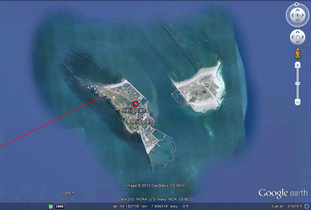
A nice blog by J. Rankin: http://thothistheibis.wordpress.com/2012/05/27/the-bush-barrow-treasures/, in which Doggerland is mentioned and the Michael Ley extended towards Denmark and mention made of the island of Heligoland situated off the corner of Denmark and Germany, which I plotted on Google Earth:

Also in this image are extensions to the south-east of the special triangle previously mentioned with its apex at Preston (unicorn)Cross, P.U.C. The most important at this time is the extension of the Callanish - Schiehallion line through PUC and Kelso which cuts the Michael Ley near Yarmouth and extends down to Mount Etna on Sicily, one of the presently(last week) fourteen active volcanoes listed on the BBC Volcano Live programme.

That was interesting in itself, but the extension to the north-west skirts Rejkyavik(sp) and at least two major volcanoes on Iceland, Katia and Hekla, ending at Snaefelljukull, presumably also volcanic!?. Very surprising, and raises the question whether this is the reason for that particular line!?

I then checked the blue line which originates at Bugarach mountain and connects with the Barra point of the triangle and was one of the two original plots in the previous post, as it too appeared to be heading for Iceland. Two volcanoes again, the first the volcano which caused so much disruption to air traffic in 2010, Oraefjelljokull(sp?), and Boroarbunga at an impressive 6000+ft.
Stunned by these findings I happened to zoom out to get an overview and became attracted to a yellow feature appearing on the horizon in the Pacific ocean and guessing this to be Hawai I noticed that the dark blue line may extend to it. And it did!

As can be seen the line crosses Greenland and northern Canada which I have not investigated yet.

The Hawaian islands, like Iceland, owe their existence to volcanic activity, and the BBC team based themselves there for the series.
In his most recent post Bill Buehler had linked Hawai with the Rennes Le Chateau area, and here is a direct connection which I had not even guessed at when I chose this particular line, with Iceland as bonus, and the Barra link to the specific triangle I have made so much of in previous posts, and Iceland and Mount Etna on the Callanish - Schiehallion -PUC hypotenuse of said triangle. I recall also Bill commenting that the Callanish - Barra alignment was very special in his systems a good many years back.
I await Bill's upcoming website before attempting to describe his work further as I am in no way competent
to even begin. What I can say is that for some 13 years now the geometry I have been researching has interlinked in many surprising ways, often in seeming synchronicity, as with this exercise!
Bill also mentioned Antartica in his latest post, and The Volcano Live team had a piece on Mount Erebus, a Cambridge team goes there every year to study Erebus, and I found it in what is described as Hot Point Peninsula. I extended the line and it does cross Antartica but a good way off Erebus:

As can be seen it passes to the east of New Zealand, also mentioned as having volcanic activity in Volcano Live, and what appears to be a long deep trench running parallel to this line, again I have not yet searched this part.

To conclude this exercise I completed the line back round to Bugarach checking that the projection was accurate, completing a Great Circle:

As can be seen the line is about as long as a line can be drawn across Africa, and includes The Congo which contains another volcano covered in Volcano Live, but I was unable to find it, forgetting its name even, but I did find one in Chad, but not very close.
Completion of the Circle, with Menorca and Girona in line:

4 comments:
Love those lines! Thanks for mentioning my blog, Thoth is the Ibis. Your site looks very interesting, have added it to my favorites. Do you know about the St.Michael-Apollo Line? It runs from Mount Carmel to Skellig Michael and has many sites connected to St. Michael and Apollo on it. The St. Michael places were originally connected to Belinus or Lugh/Lugus. All gods connected to light and enlightenment, justice also I'd say. Heligoland is connected to Forseti another god of light and justice.
Some other sites you might find interesting are Ancient-wisdom.uk.co, Ancient Celtic New Zealand, and Derek Cunningham's papers at Midnight Science Journal. He makes an incredible case for Cygnus. The Cygnus over Scotland was still recorded in the Chi RHo or XPI pages of the Book of Kells, made on Iona and the Lindisfarne Gospels which was made at Holy Island. Have a piece on my blog about how these connect to the Brodgar Complex in the Orkneys. Think there were ancient astronomer/surveyor/navigators around a long time ago. We're just discovering what they left behind.
Cygnus over Scotland I didn't know of, I'll check out your blog! Neil Oliver did a programme on the work being done at Brodgar which was very interesting. Whoever they were they were good. The accuracy I find astonishing, but then Haagensen on Bornholm proves the Templars were at least involved. How far back it goes no one seems sure, but it seems to be planet wide.
Hi Tom, have been very busy and have not been back here.
I see you mention the Templars on Bornholm Island, and they may have been there, but the geodesy on the landscape was already there long before they were there. I think the Templars were one group who did understand the ancient geodesy left on the landscape thousands of years before they came along.They also seem to have understood the message in the Sator Square and helped to spread it around. A lot of good it did, if folks eventually thought it was about farmers and that it was Christian.
Very interesting to see those lines come down from Scotland. Callanish actually looks like a long legged bird. See my blog for the diagram. Odd thing, Callanish is 5 degrees north and five degrees west of Arbor Low where you will find a recumbant white stone 'circle' which is actually egg shaped.
Interesting to see Lindisfarne listed there. It is the head of Cygnus on Derek Cunningham's map.Lindisfarne has one of those interesting XPI pages which also have to do with the Orkneys, astronomers, calendar keepers, surveyors and navigators. It is also 4 degrees north of Stonehenge.
One of your lines runs through Ontario, Canada, and I wonder if it might run close to a coppermine around the Peterborough area, or some other place in Canada. Apparently there was tons of copper extracted in Ontario in ancient times. The copper didn't stay in North America, so more of that navigator group. Everywhere they went, they were looking for minerals and rock, among other things, but that was likely at the top of the list.
Those really ancient folk created quite a 'network' both on land and by sea.
Good evening Tom Graham!
I came across your website while surfing the net.
https://unicorngeometrics.blogspot.com/2012/07/google-earth-exercise-contd.html
The 2nd photo from the top immediately caught my attention!
There you see leylines crossing a point in Germany called "Allagen Kerk".
As luck would have it, that's not far from me!
Unfortunately, a search for it on the internet was unsuccessful!
Can you tell me who found this point, I might be able to expand the knowledge about this place a bit more and uncover new connections.
with kind regards
Tom
Translated with www.DeepL.com/Translator (free version)
Post a Comment